Hiking in Tsing Yi
As we move into late spring, the weather in Hong Kong is becoming increasingly humid. This can make hiking more challenging, as sunny or strenuous trails are best avoided during this time of year. Luckily, Hong Kong offers many rewarding hiking options that are well-suited for the late spring conditions.
One such hike is on the island of Tsing Yi (青衣), located west of Kowloon. Tsing Yi is known for its large container terminal in the southeastern part of the island, but it’s countrytrails also features interesting views over Hong Kong and Kowloon. The highest peak on the island is Sam Chi Heung South Peak (三支香南峰). This peak’s name comes from the three “incense sticks” or peaks - North, Middle, and South. Aside from these tree peaks, the northern part of Tsing Yi is home to a network of well-maintained country trails.
I began my hike by exiting the MTR station at the island’s coastline and heading north. After passing some housing estates, I found the entry to the nature trails on the left side. A short climb brought me to the Cheung Wang estate, where the actual hiking portion began as I left the street and entered the forested trail. Much of the trail was shaded, which was a welcome relief from the humidity.
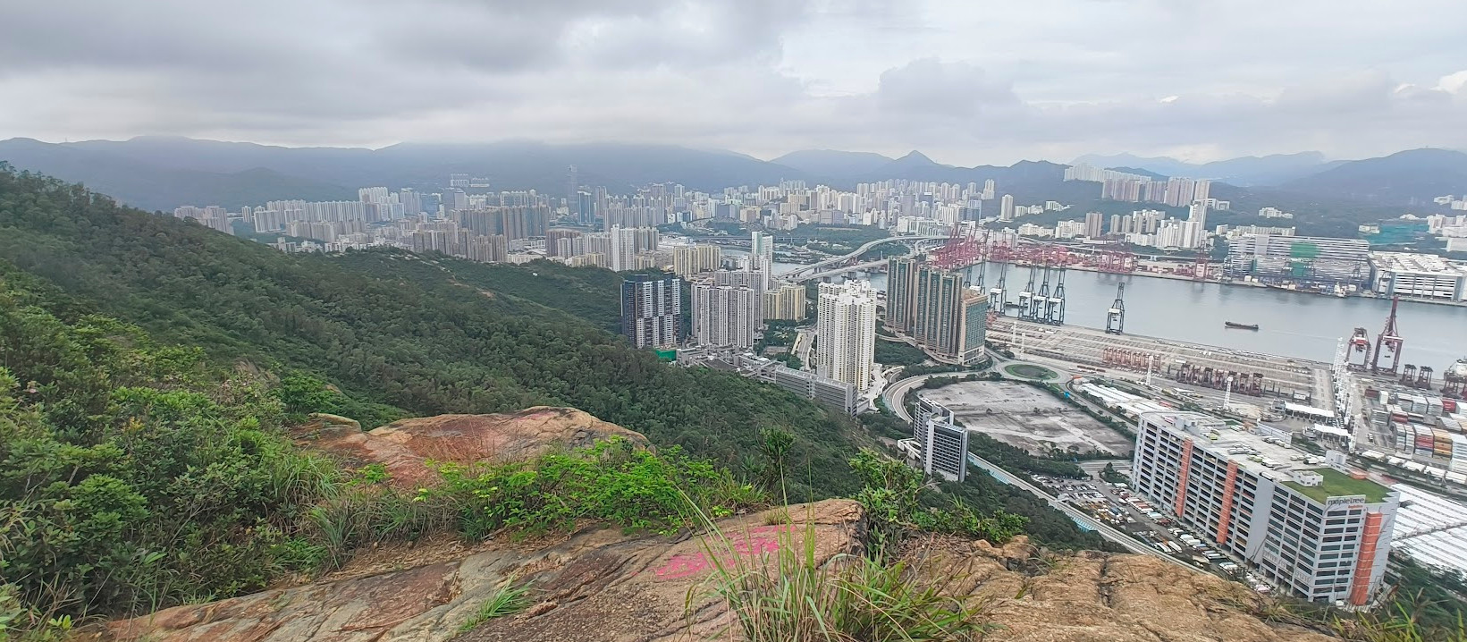
Following the Tsing Yi Nature Trail, I came across some pavilions that offered panoramic views of the Tsing Ma Bridge towards the neighboring island of Ma Wan (馬灣). Continuing on, I passed by Liu To Peak (寮肚山) before descending to a street and then climbing towards the three peaks of Sam Chi Heung.
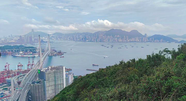
The initial ascent to the Sam Chi Heung peaks was quite steep, but the trail was well-maintained. After passing a gravesite, I followed a forest trail to reach the South Peak. The views from just behind the peak itself were truly rewarding, offering a panoramic vista of Hong Kong Island. There was a less maintained and steeper trail down to Tsing Yi, but as I was hiking alone and the trail was believed to be slippery, I chose to return the same way I had hiked up. Finally I descend towards the street at which buses to Kowloon are available.
Key Facts
Length: 10.0 km
Uphill: 490 m
Downhill: 430 m
Shadow: Mostly Shady
Level: Moderate
Map
Further Links
https://droneandslr.com/travel-blog/hong-kong/tsing-yi-peak-hike/